Beirut Built Environment Database
The Beirut Built Environment Database is a platform gathering geolocalised social, environmental, and economic information on building activity in the Greater Beirut Area.

Responding to the lack of accessible raw data about the built environment in Lebanon’s capital city, the Beirut Built Environment database brings together a collection of maps, documents, and surveyed indicators about actors (e.g., builder, developer, landowner) as well as spatial (e.g., vacancy, floors, parking) and environmental characteristics (e.g., water, greenery, infrastructure lines) that can inform ongoing research, public policymaking, and advocacy about the city. Aside from providing a shared base of information for/about Beirut, the database serves as a basis for ongoing theorization of urban transformation, including the rising rates of vacancy, forced evictions, developers’ trajectories, environmental justice, and more aspects of the actually existing financialization of land and its impacts on everyday life in the city. The platform invites researchers, professionals, and activists who are interested in investigations of the city's built environment to rely on its layers as a basis for more advanced explorations of urban trends. Our aim is to provide an easy-to-share, free to download document as a strategy to generate collaborations, partnerships, and most importantly discussions about the rapid transformations of the city and their visualization.

Lead: Mona Fawaz, Ibrahim Alameddine, and Ahmad GharbiehFieldwork Coordination and Data Management: Michelle MoawadGIS Database Management and Data Geolocalization: Shareef TarhiniPlatform Design: Nour Zoghbi Fares and Ismail HutetAssistance in building footprint mapping: Ali DawiField Researchers: Abir Zaatari, Diala Makki, Reem Salameh, Soha Mneimneh, Yara Nahle, Yusra Bitar, and Zeinab Chammas. Our thoughts go to Eva Khalil who would have been proud to see the fruits of her work.You can access the database by clicking here, storymap by clicking here, and download our basemap by clicking here.

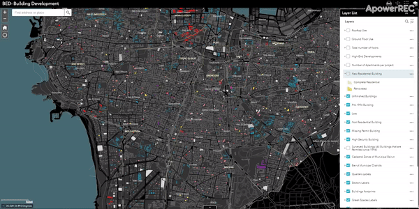
The Creation of a Base Map

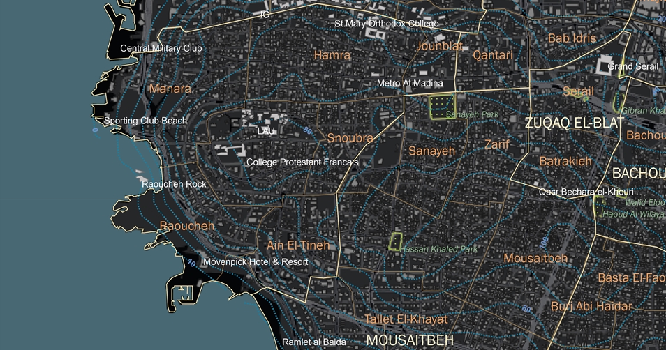
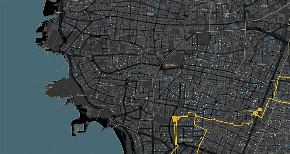
In the absence of a reliable map for Municipal Beirut, the first task for the Built Environment Database’s team was the development of an accurate base map that includes georeferenced cadastral and building footprint indicators, as well as streets and main landmarks. To this end, the team consolidated existing city maps available to private offices and public agencies into a single document. All imperfections were verified through direct documentation with the Public Land Agency and/or direct surveys on the ground and up to date aerial photography. This work was conducted in collaboration with the National Council for Scientific Research (CNRS). The final base map includes building footprints, property boundaries, roads, sewer networks, and Electricité du Liban’s official neighborhood divisions. The map will be updated regularly and layers will be added as research and data gathering progress.

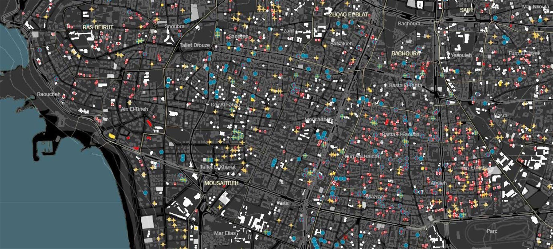
An In-depth Look at Beirut’s Built Environment

Based on data obtained from the Order of Engineers and Architects in Beirut, we surveyed 2,692 sites in Beirut, lots where building permits had been filed in the 1996-2018 period. Additional information was gathered for the 1,634 residential developments identified on-site. Data collected includes social, physical, and environmental attributes for each of these buildings. We also gathered additional data on vacant lots and open spaces, as a prelude for the investigation of potential common spaces benefiting city dwellers.

The created base map contains layers with elevation contour lines, cadastral zones, municipal districts, main and secondary roads, property parcels, building footprints, green spaces, and a selection of landmarks.
The base map also contains water network infrastructure, with the existing pumps and reservoirs.
Users can access a map of 2,692 construction permits filed between 1996 and 2018, classified as residential and non-residential permits. It also shows the construction status of each permit (parking, evicted building, construction completed, etc)
 For completed residential buildings, an additional set of data is available, such as the vacancy rates shown above at the municipal district scale, and available up to the building scale.
For completed residential buildings, an additional set of data is available, such as the vacancy rates shown above at the municipal district scale, and available up to the building scale.

Expanding the Database in the Greater Beirut Area

The Built Environment Database is expanding its work in the Greater Beirut Area to cover additional neighborhoods of the city’s urbanization. In addition, we are looking to expand the analysis of Lebanon’s urbanization through the study of Lebanon’s secondary cities where work in Tyre has already begun. 

The Built Environment Database is expanding its work in the Greater Beirut Area to cover additional neighborhoods of the city’s urbanization. In addition, we are looking to

expand the analysis of Lebanon’s urbanization through the study of Lebanon’s secondary cities where work in Tyre has already begun.